


 Sports & Fitness
 Activity Tracking
 Running Watches
 Adventure Watches
 Smart Watches
 Dive Watches
 Cycling
 Cycling Trainers
 Watch Accessories
 Cycling Accessories
 Recovery equipment
 Darts
Darts Smart Scale - Healthcare
 Automotive
 Navigators
 Handhelds
 Navigators Accessories
 GPS Maps
 Outdoor & Camping
 Backpacks & Wallets
 Flashlights & Accessories
 Multitools
 Tubular Headwear
 Sports Sunglasses
 Boards
 Headphones & Speakers
 Headphones
 Speakers
 Computer Accessories
 Mobile Accessories
 Αction Cameras
 Action Cameras
 Drones
 Accessories
 Consumer License Free PMR446
 Business Radio PMR446
 VHF-UHF Ναυτικοί
 Marine
 Marine GPS/Fishfinder Combos
 Fishfinders
 VHF-UHF Ναυτικά
 Bluetooth Speakers & Radios
 Marine Accessories
 Dog Tracking & Training Devices
 Device Accesories
 Grooming accessories
 Αξεσουάρ περιποίησης προσώπου


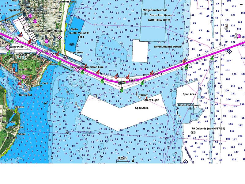
Featuring vibrant colors, a streamlined interface and combined coastal/inland content with a popular Navionics® style color palette, Garmin Navionics+ cartography makes it easy to plot your course with the world’s No. 1 name in marine mapping1.

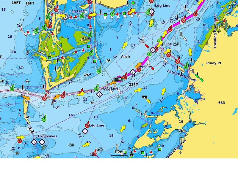
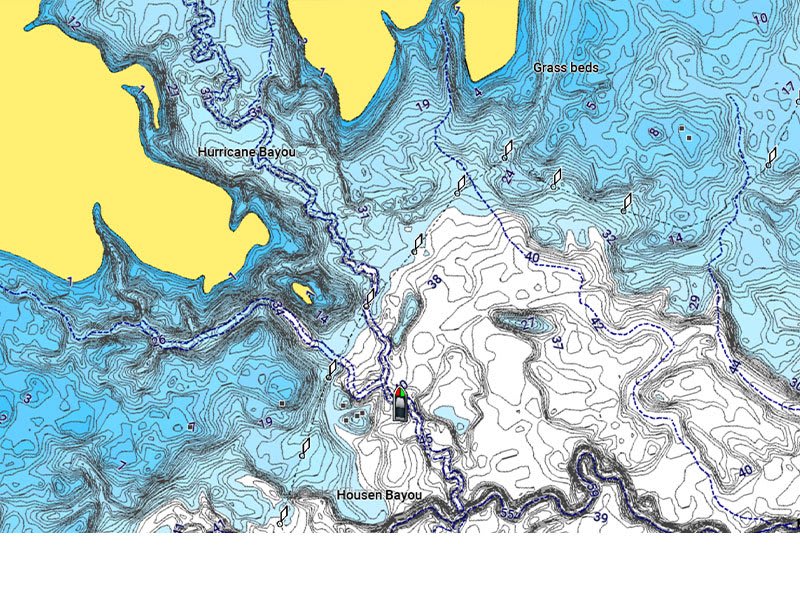
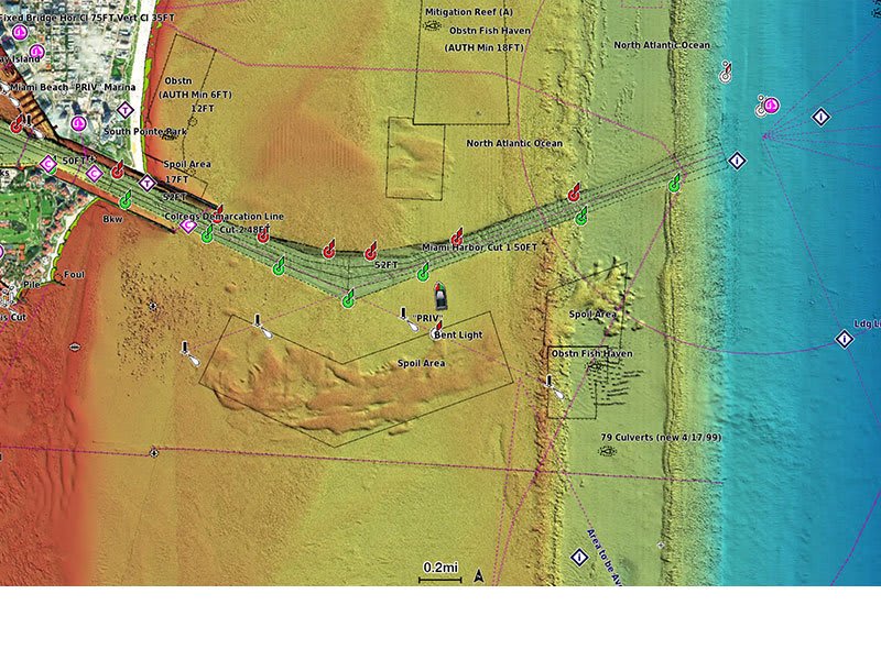
Access detail-rich mapping of coastal features, lakes, rivers and more. Integrated Garmin and Navionics® content offers coverage for boaters worldwide.
Charts are constantly being enhanced with new and amended content — as many as 5,000 updates are made every day. The one-year included subscription gives you access to daily chart updates via the ActiveCaptain app.
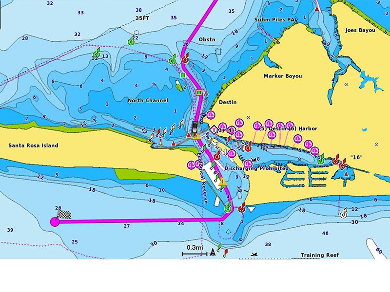
Combining the best of Garmin and Navionics automatic routing features, built-in Auto Guidance+ technology2 gives you a suggested dock-to-dock path to follow through channels, inlets, marina entrances and more.
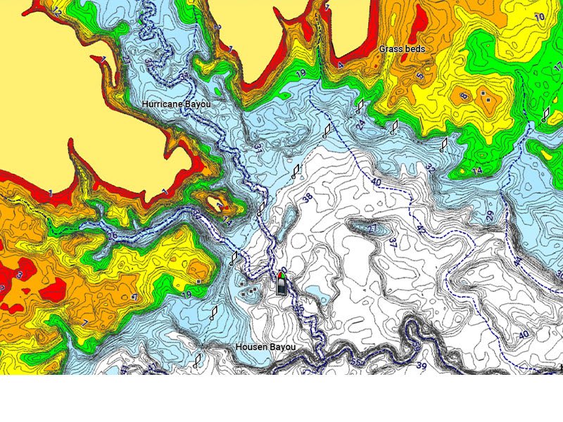
High-resolution depth range shading lets you select up to 10 color-shaded options and view your designated target depths at a glance.
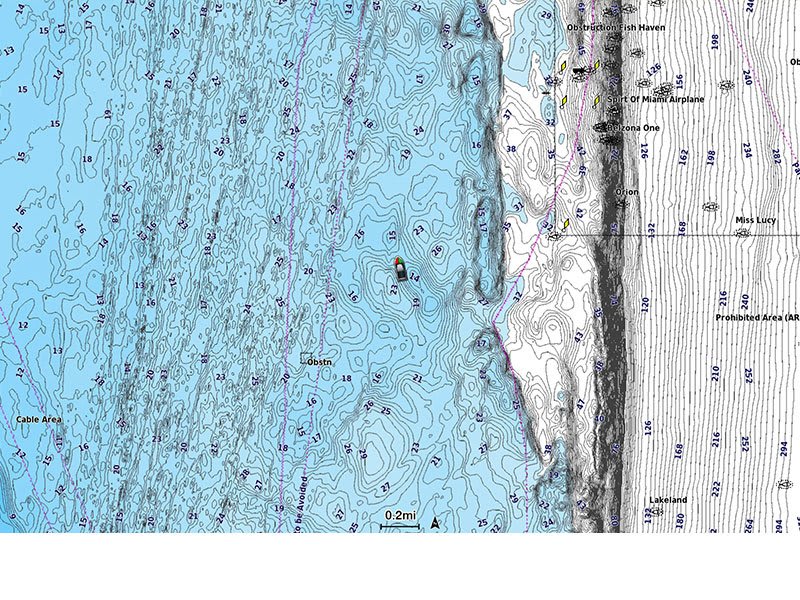
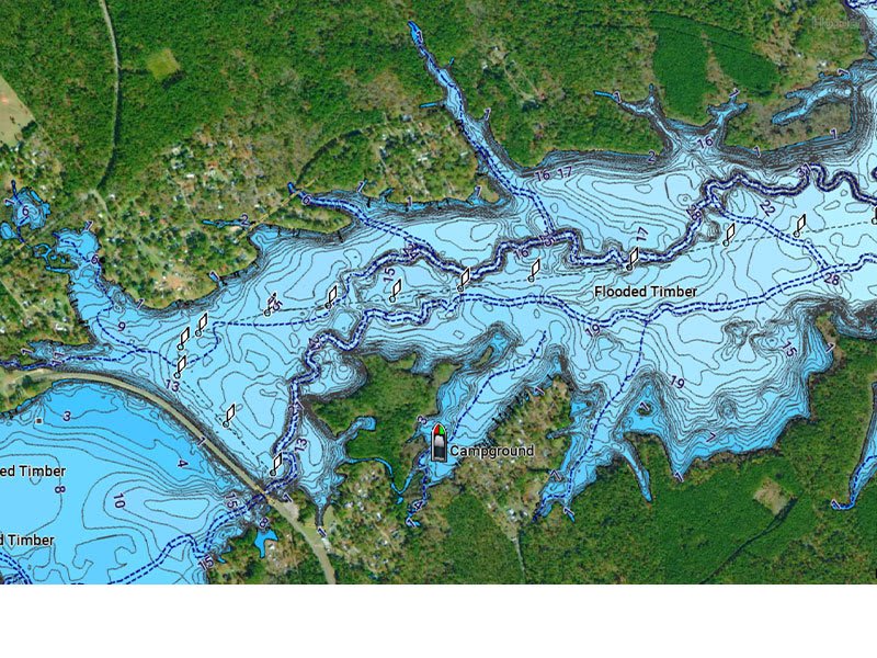
For improved fishing and navigation, up to 1' contours provide a clear depiction of bottom structure for improved fishing charts and enhanced detail in swamps, canals, harbors, marinas and more.
To give a clear picture of shallow waters to avoid, this feature allows for shading at a user-defined depth.
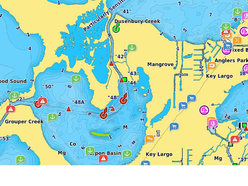
Community-sourced content provides useful POIs, such as marinas, anchorages, hazards, businesses and more. Get recommendations from boaters with firsthand experience of the local environment.
This downloadable shading feature4 combines color and shadow to give you an easy-to-interpret, clearer view of bottom structure than contour lines alone.
Downloadable high-resolution satellite imagery4 provides superior situational awareness.
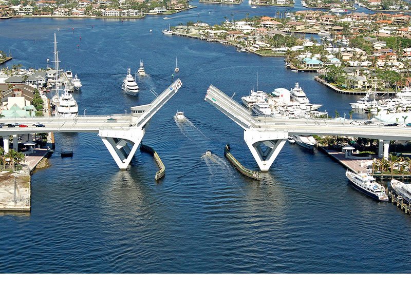
Crystal-clear aerial and surface photos of ports, marinas, bridges, docks, boat ramps, dams and navigational landmarks provide a better sense of your surroundings above the waterline.
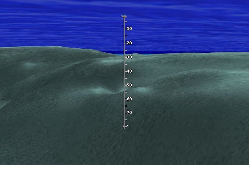
This underwater perspective shows 3D representation of bottom and contours as seen from below the waterline. Interface with sonar data for a customized view.
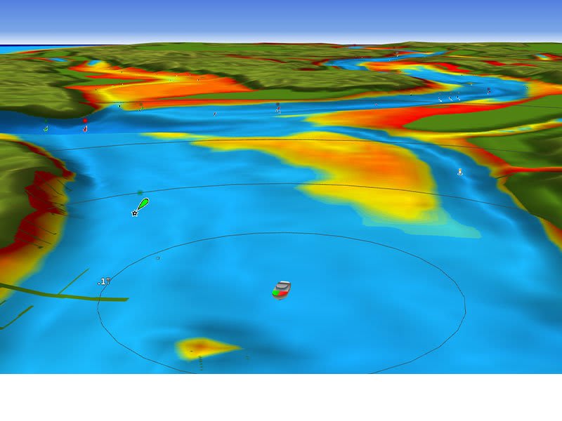
This view provides a 3D representation of the surrounding area both above and below the waterline.
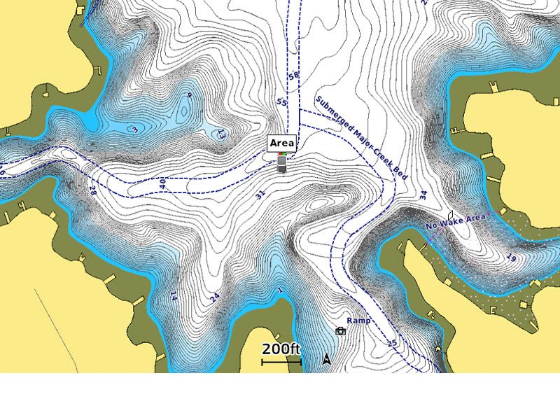
Adjust your maps to the lake’s current water levels to see if spots are accessible or too shallow to explore.
Data sheet
Specific References
We will send a replacement (Credit Request). We will pick up the item you wish to return within 6 days. We hope you understand that we can only accept items for return if they have not been used or tampered with. Original packaging and accessories also need to be returned along with the item.
Για περισσότερες πληροφορίες πατήστε εδώ to get more details
No customer reviews for the moment.