Sports & Fitness
 Activity Tracking
 Running Watches
 Adventure Watches
 Smart Watches
 Dive Watches
 Cycling
 Cycling Trainers
 Watch Accessories
 Cycling Accessories
 Recovery equipment
 Darts
Darts Smart Scale - Healthcare
 Automotive
 Navigators
 Handhelds
 Navigators Accessories
 GPS Maps
 Outdoor & Camping
 Backpacks & Wallets
 Flashlights & Accessories
 Multitools
 Tubular Headwear
 Sports Sunglasses
 Boards
 Headphones & Speakers
 Headphones
 Speakers
 Computer Accessories
 Mobile Accessories
 Αction Cameras
 Action Cameras
 Drones
 Accessories
 Consumer License Free PMR446
 Business Radio PMR446
 VHF-UHF Ναυτικοί
 Marine
 Marine GPS/Fishfinder Combos
 Fishfinders
 VHF-UHF Ναυτικά
 Bluetooth Speakers & Radios
 Marine Accessories
 Dog Tracking & Training Devices
 Device Accesories
 Grooming accessories
 Αξεσουάρ περιποίησης προσώπου


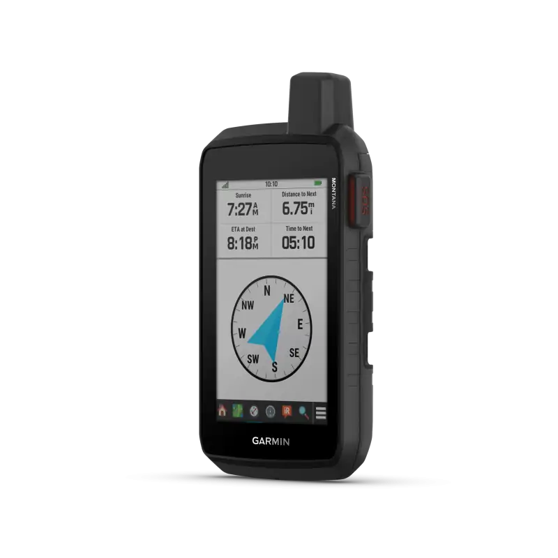
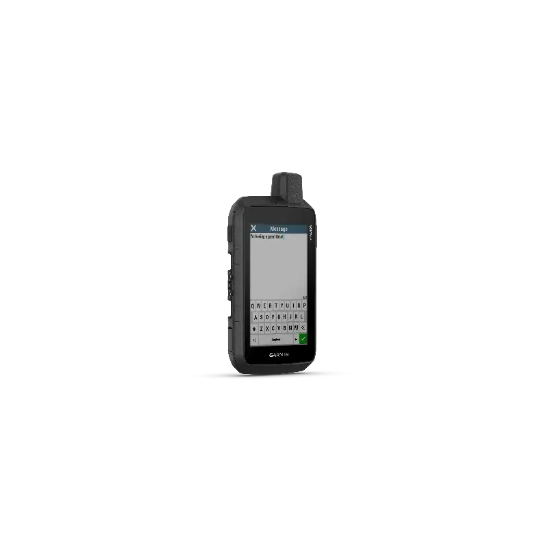
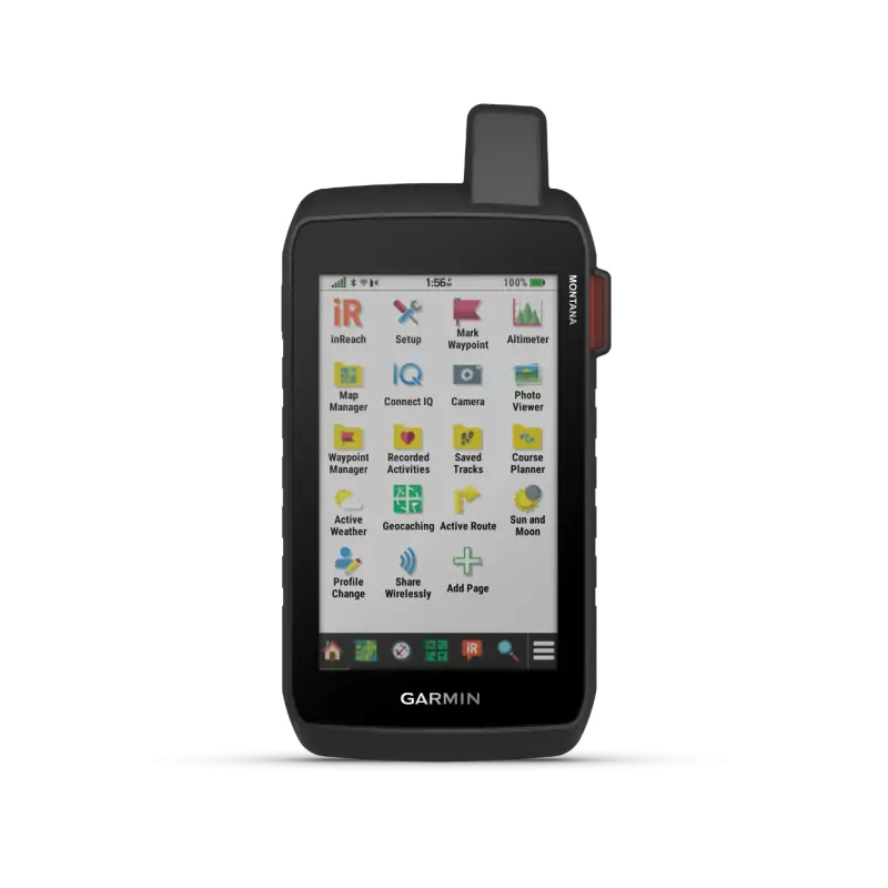
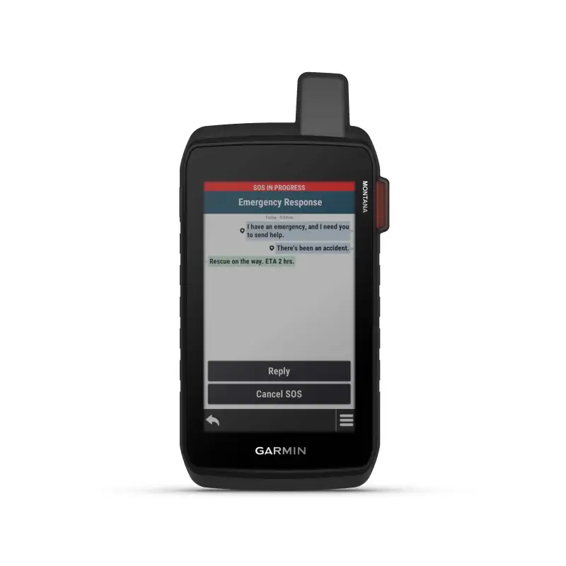
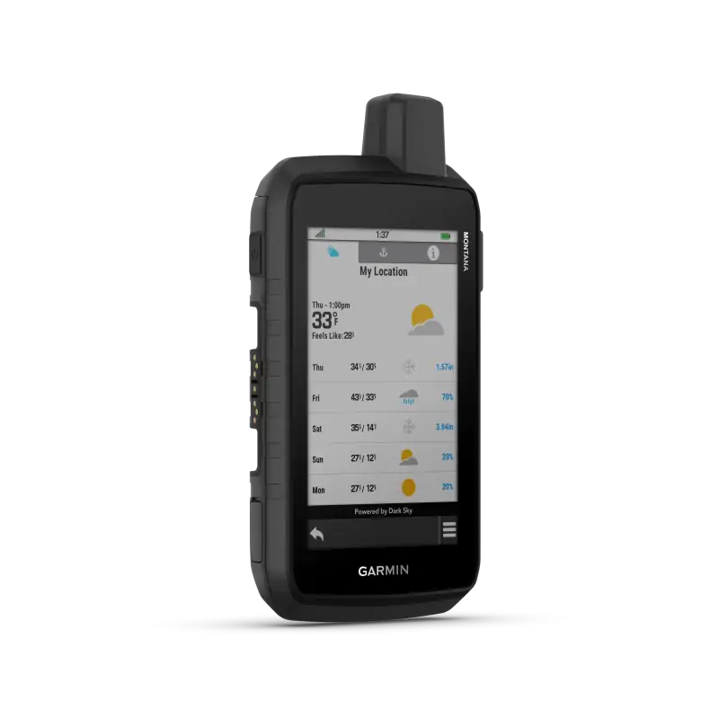
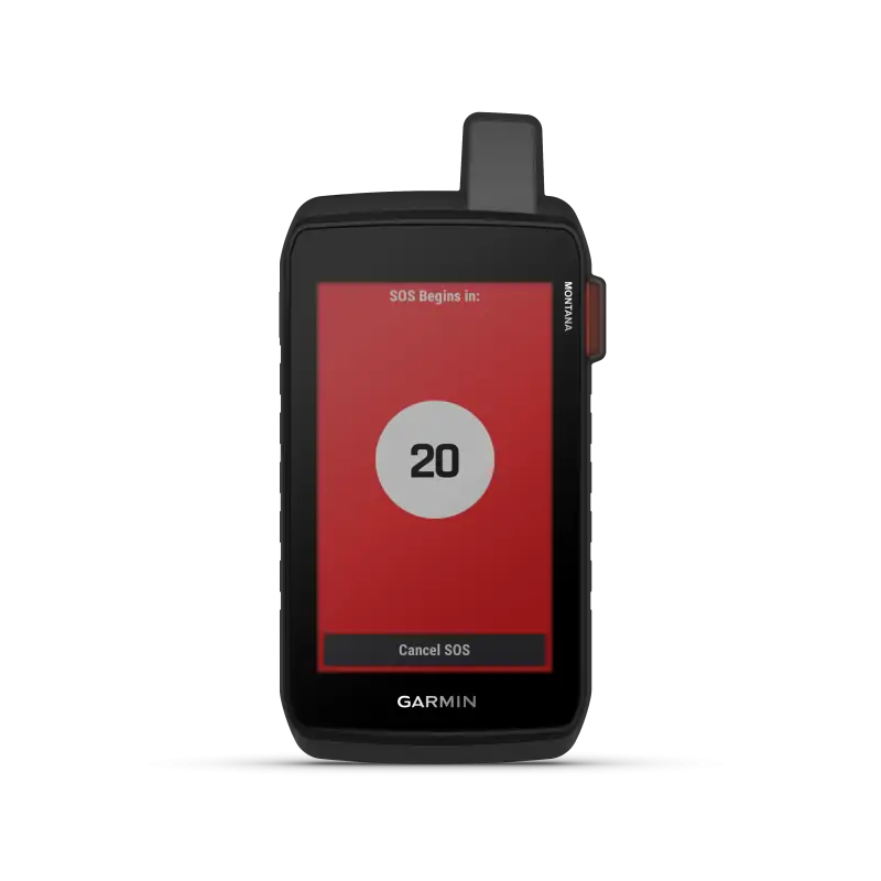

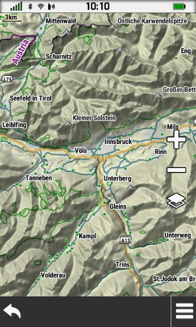
Stay on track and in touch with the rugged Montana 710i GPS. Designed to guide you on any adventure, Montana includes TopoActive maps, a 5" glove-friendly color touchscreen and long battery life. By combining an active inReach® subscription and a Montana 710i or 760i with built-in inReach technology, you can stay in touch via two-way messaging and interactive1 SOS even when your wanderings are out of cellular coverage.

BUILT-IN INREACH TECHNOLOGY
With an inReach subscription, the Montana 710i and 760i allow you to stay in touch when you wander off-network. Instead of relying on cellular coverage, now your messages can be carried over the Iridium Global Network2 with 100% coverage.
DURABLE, 5" TOUCH SCREEN
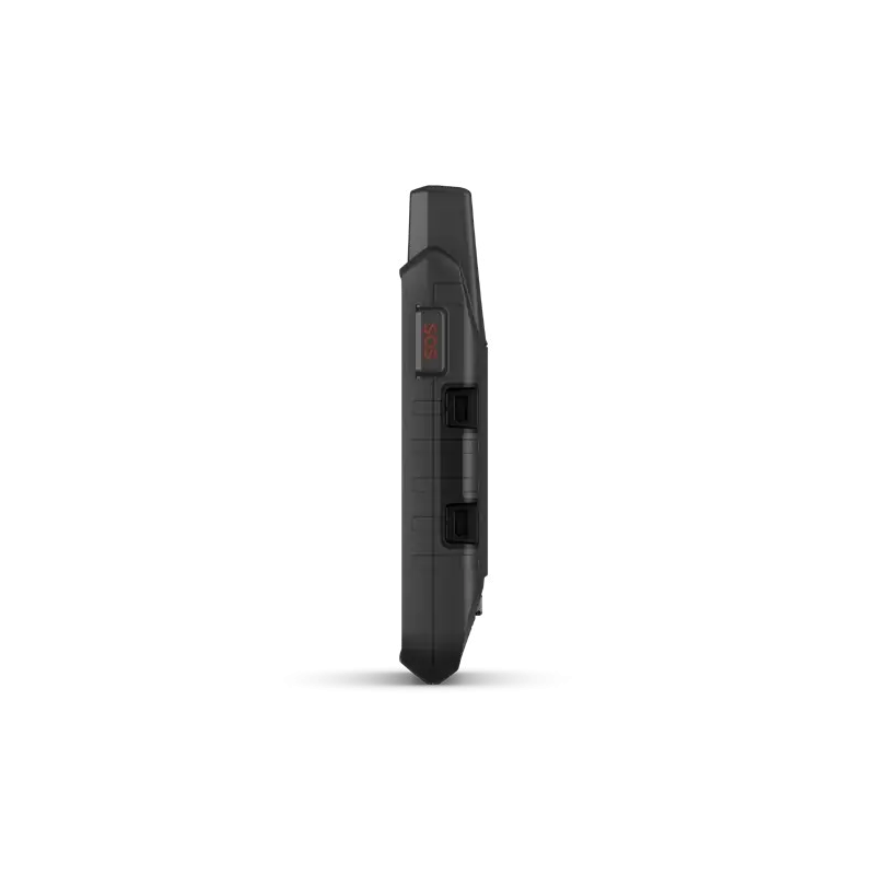
This durable, waterproof device has been tested to MIL-STD 810 for resistance to temperature, drops, water and vibration. It features a 5" touchscreen, suitable for use with gloves and is compatible with a variety of mounting solutions (sold separately) to best suit your activities
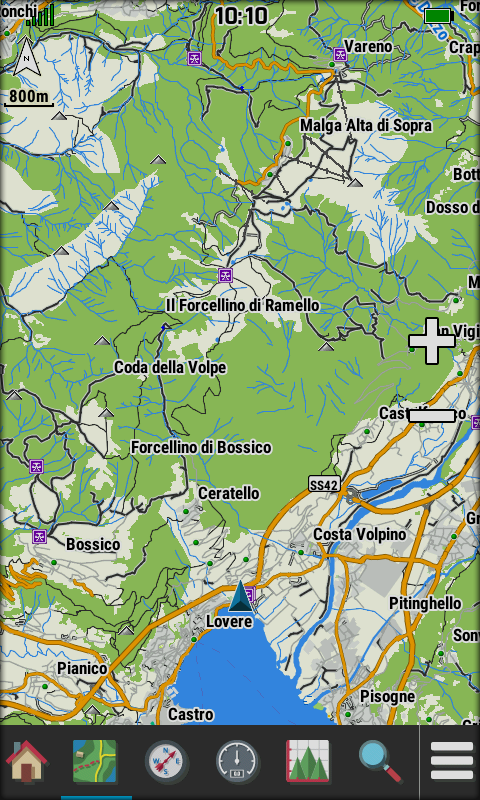
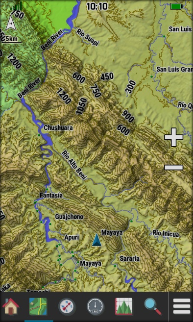 TOPOACTIVE MAPS
To navigate your adventures, use the preloaded maps for Europe, TopoActive . You can download for global coverage via Wi-Fi. See elevation, elevation, coastlines, rivers, landmarks and more.
OUTDOOR MAPS+
Purchase an Outdoor Maps+ subscription for continuous access to a wide variety of high-coverage content and regular updates directly on your Garmin device via Wi-Fi® technology.
MULTI-GNSS SUPPORT
Access to GPS and Galileo satellite networks allows the Montana 710 to be tracked in more challenging environments than GPS alone.
RUGGED BY DESIGN
This durable, water-resistant handheld is tested to meet MIL-STD 810 for thermal, shock, water and vibration. It features a glove-friendly 5-inch touchscreen and is compatible with a variety of robust mounting solutions (sold separately) to best suit your activities.
TOPOACTIVE MAPS
To navigate your adventures, use preloaded worldwide topographical maps. View terrain contours, elevations, coastlines, rivers, landmarks and more.
SATELLITE VIEWS
Access subscription-free, high-resolution satellite imagery with direct-to-device downloads over Wi-Fi® connectivity. See photorealistic overhead views of routes and surrounding terrain, and easily create waypoints based on landmarks.
ADDITIONAL MAPS
With 32 GB of onboard memory, you can download even more maps, such as City Navigator® maps for your drive or BlueChart® g3 charts for the water (sold separately).
OUTDOOR MAPS+
With a subscription to Outdoor Maps+ (sold separately), get ongoing access to a wide variety of premium mapping content and regular updates sent right to your Garmin device via Wi-Fi technology.
GARMIN EXPLORE APP
Pair with the Garmin Explore app to plan and review trip data, plus manage your waypoints, courses and activities.
NAVIGATION FEATURES
MULTI-GNSS SUPPORT
Access to GPS and Galileo satellite networks enables Montana 710 to track in more challenging environments than GPS alone.
ABC SENSORS
Navigate your next trail with ABC sensors, including an altimeter for elevation data, barometer to monitor weather and 3-axis electronic compass.
ACTIVE WEATHER
Access up-to-date active weather forecasts via the Garmin Connect™ app on your compatible smartphone.
DOG TRACKING
For hunters and trainers, this Montana handheld syncs with your compatible Astro® or Alpha® series handhelds to help track sporting dogs in the field.
WIKILOC TRAILS
This preloaded app lets you easily download hiking, cycling and other Wikiloc trails shared by outdoor enthusiasts like you. Get a free 60-day Wikiloc Premium trial to try this and other exclusive features. Learn more.
ADVENTURE FEATURES:
PUBLIC LAND BOUNDARIES
Optional display of federal public land boundaries on topographical maps helps you know that you’re venturing where you’re supposed to be.
EXPEDITION MODE
Trek far and wide off-grid. Use expedition mode, an ultralow-powered GPS reference, to keep Montana tracking for more than 2 weeks between recharges.
BATTERY OPTIONS
A rechargeable lithium-ion battery pack provides up to 24 hours of battery life in GPS mode and charges with a standard USB-C® cable. It can also be powered with traditional AA batteries (not included).
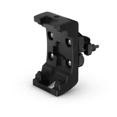
VEHICLE MOUNTS
A variety of Montana handheld-compatible mounts (sold separately) lets you adapt your navigator for use on ATVs, boats, cars, motorcycles, RVs or other vehicles.
Data sheet
Specific References
We will send a replacement (Credit Request). We will pick up the item you wish to return within 6 days. We hope you understand that we can only accept items for return if they have not been used or tampered with. Original packaging and accessories also need to be returned along with the item.
Για περισσότερες πληροφορίες πατήστε εδώ to get more details
No customer reviews for the moment.