Sports & Fitness
 Activity Tracking
 Running Watches
 Adventure Watches
 Smart Watches
 Dive Watches
 Cycling
 Cycling Trainers
 Watch Accessories
 Cycling Accessories
 Recovery equipment
 Darts
Darts Smart Scale - Healthcare
 Automotive
 Navigators
 Handhelds
 Navigators Accessories
 GPS Maps
 Outdoor & Camping
 Backpacks & Wallets
 Flashlights & Accessories
 Multitools
 Tubular Headwear
 Sports Sunglasses
 Boards
 Headphones & Speakers
 Headphones
 Speakers
 Computer Accessories
 Mobile Accessories
 Αction Cameras
 Action Cameras
 Drones
 Accessories
 Consumer License Free PMR446
 Business Radio PMR446
 VHF-UHF Ναυτικοί
 Marine
 Marine GPS/Fishfinder Combos
 Fishfinders
 VHF-UHF Ναυτικά
 Bluetooth Speakers & Radios
 Marine Accessories
 Dog Tracking & Training Devices
 Device Accesories
 Grooming accessories
 Αξεσουάρ περιποίησης προσώπου


Get A Sharper View From Your Connected Helm
With its sleek design, powerful processing and upgraded IPS display, this advanced 7”, 9”, 12” or 16” chartplotter integrates seamlessly into your Garmin marine system.


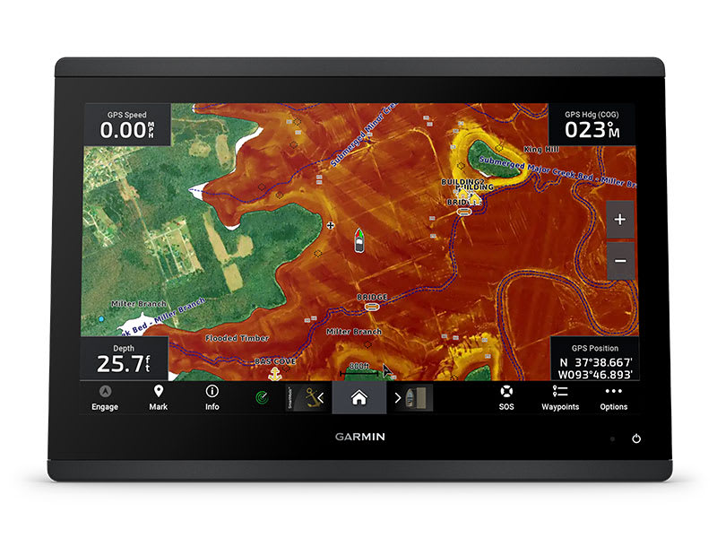
Ultra High-Definition Scanning Sonar
Get built-in Ultra High-Definition SideVü™ and ClearVü™ scanning sonars with vivid, high-contrast color palettes to help distinguish fish from structure. The GPSMAP X3 chartplotter series also supports 1 kW traditional sonar capabilities.
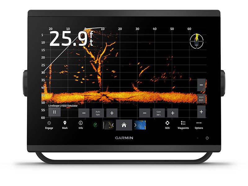
Live Sonar Support
Pair with Panoptix™ or LiveScope™ easy-to-interpret live sonar (transducer required, sold separately) to see all around your boat in real time.

Faster, Sharper, Smarter
With its added processing power and slimline design featuring edge-to-edge glass, it’s easy to fit this plotter in a wider range of dash configurations.

Bright And Clear Optics
High-resolution IPS displays for 9”, 12” or 16” chartplotters offer improved sunlight readability and visibility from any angle.

Preloaded Mapping
Experience unparalleled coverage and detail with built-in Garmin Navionics+™ integrated coastal and inland mapping that includes Auto Guidance+™ technology (2) and a 1-year subscription for downloadable daily updates and more on select chartplotters.

Optional Charts And Maps
Bring a fresh new look and feel to your chartplotter with an optional upgrade to a Garmin Navionics Vision+™premium chart subscription, featuring downloadable high-resolution relief shading, satellite imagery, sonar imagery and more.

Optional Radar Bundle
To help you avoid weather and traffic on the water, the compact 4 kW GMR™ 18 HD3 dome radar is available as a bundled option with select GPSMAP chartplotter/sonar packages.

Power-Pole Shallow Water Anchor
By networking your select Garmin chartplotters with a Force® trolling motor and your compatible Power-Pole shallow water anchoring system, you can access advanced boat control features (3) from your plotter, including smart anchor auto-deployment, smart anchor jog, auto stow, anchor drag detection and end-of-route anchoring. Spend more time fishing, less time positioning.

Trolling Motor Intergration
Get support and integration for your Force trolling motor (sold separately) to gain complete control while you fish.

Charge Intergration From Power-Pole
Your CHARGE Marine Power Manager from Power-Pole integrates with compatible Garmin chartplotters to help keep your battery power going longer and stronger on the water. You’re able to charge batteries on the run, monitor power use, select where power is allocated, control emergency starts and even transfer power between battery banks — all from your chartplotter display.


Garmin Sailassist Sailing Features
View laylines, race start line guidance, enhanced wind rose, heading and course-over-ground lines, true wind data fields and tide/current/time slider, wind angle, set and drift, wind speed and more.
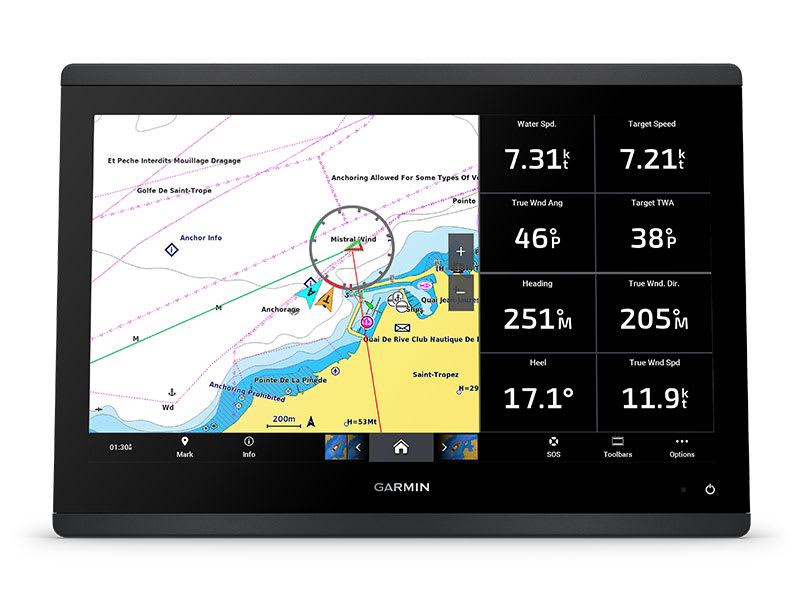
Sailing Polars
Use the polar table to see key data, including how fast you should go at a certain wind angle and speed — so you know whether you need to adjust sail trim.
Garmin Marine Network
If you have multiple compatible Garmin devices on your boat, you can share information — such as maps, user data, radar and IP camera video — among them.

NMEA 2000 And NMEA 0183 Networks
Connect to compatible autopilots, digital switching, weather, the Fusion audio system, media, VHF, AIS and more from one screen.

Activecaptain App
Built-in Wi-Fi® connectivity pairs with the free all-in-one mobile app for access to the OneChart™ feature, smart notifications, software updates, Helm app, Garmin Quickdraw™ Community data and more (1).

Intergrated Ant Technology
Connect with some of your favorite devices, such as quatix® marine watches, gWind™ Wireless 2 transducers, GNX™ Wind marine instruments and wireless remote controls.

Engine Connectivity
You can connect your chartplotter to different engines, including select Yamaha® engines.

Onehelm Feature
This feature brings together all the operations and capabilities of select third-party devices, such as EmpirBus™ digital switching, on one screen.

Send inReach Device Messages
Pair your inReach satellite communicator (4) to your chartplotter, and type custom messages by using your MFD’s on-screen keyboard. Access your contact list, or enter an email, inReach address or phone number. You can also group messages by conversation for a texting-like experience.

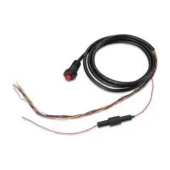
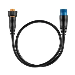
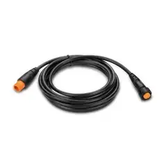
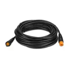
Inside The Box:
1. Requires ActiveCaptain app on your compatible smartphone paired to your chartplotter
2. Auto Guidance+ is for planning purposes only and does not replace safe navigation operations
3. Integration of these features requires purchase of a C-Monster® GATEWAY through Power-Pole
4. Active satellite subscription required. Some jurisdictions regulate or prohibit the use of satellite communication devices. It is the responsibility of the user to know and follow all applicable laws in the jurisdictions where the device is intended to be used.
(2 years Greek dealership warranty)
Data sheet
Specific References
We will send a replacement (Credit Request). We will pick up the item you wish to return within 6 days. We hope you understand that we can only accept items for return if they have not been used or tampered with. Original packaging and accessories also need to be returned along with the item.
Για περισσότερες πληροφορίες πατήστε εδώ to get more details
No customer reviews for the moment.